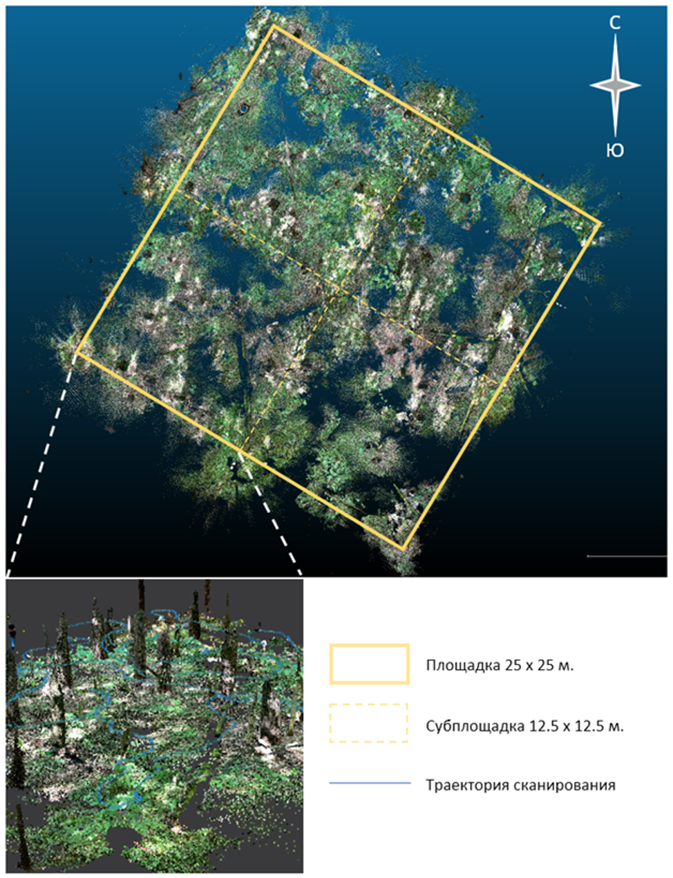
As the website of the Center for Forest Ecology and Productivity (CEPF RAS) reports, as part of Type 1 intensive level test site arrangement in the Bogorodsky Urban District (Noginsk, Moscow Oblast) for the key innovative government project, A.B. Alekseev, a graduate student of the Center, carried out personal laser scanning of the ground cover and forest stand at a height of up to 2 m using an iPhone 14 Pro equipped with a lidar sensor on an area (25×25 m) of one of the test sites.
The lidar survey resulted in a three-dimensional image as a cloud of laser reflection points. The image is colored in the real colors of the objects. The obtained data represents a detailed 3D image of the forest stand and ground cover, which makes it possible to determine the diameters of trunks at chest height (1.3 m), build a local model within the boundaries of the survey of the spatial position of trees, perform various office measurements and visual assessment of survey objects.